How do I access measurement data from my Clarity Devices?
There are three ways to view and work with the data from your Clarity devices:
- The Clarity Dashboard: your secure, sign-in web app for managing devices and exploring measurements.
- The Clarity API: programmatic access for integrating your data with other platforms.
- Clarity OpenMap: a free public map where you can choose to share your air quality data with your community.
Each is described below. If you ever get stuck, email us at support@clarity.io and we'll be happy to help.
1. Clarity Dashboard
The Clarity Dashboard is a secure platform where you can:
- Configure and manage your devices, both nodes and modules
- View live and historical data and generate insights
- Download your air quality data as
.csvfiles
Finding your way around
After you sign in, the Dashboard opens on the Live Data page. Everything is reached from the grouped left sidebar, which is organized into sections:
- Air quality: Live Data, Historical Data
- Sensor network: Monitoring Locations, Devices
- Data quality: Collocations, Calibrations
- Sharing: OpenMap, Custom Apps
- Organization: Users, Settings
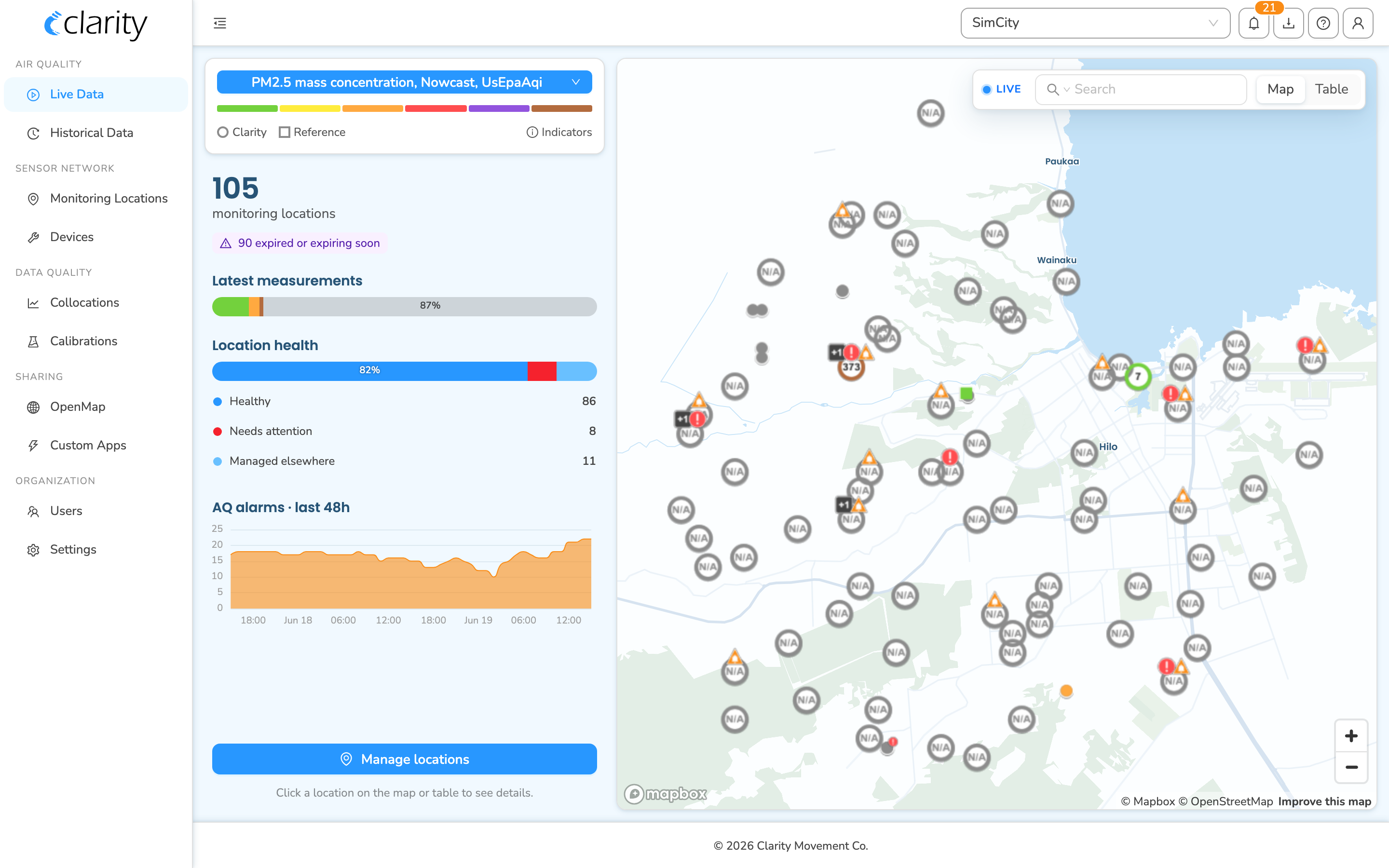
Live Data: your network at a glance
Live Data, the landing page, shows the current air quality across all of your monitoring locations.
- The map on the right plots every monitoring location, with each marker colored by its most recent measurement on the chosen metric. Use the Map / Table toggle in the top-right to switch between the map and a sortable table. There's a Search box for finding a location by name, group, tag, or device/node/module ID.
- The metric controls at the top of the left panel let you pick which pollutant and metric to display (for example, PM2.5 mass concentration, Nowcast, US EPA AQI) and which product family to show. A color legend and a Marker indicators key explain what the marker colors and badges mean.
- The summary panel on the left, shown when nothing is selected, gives your total monitoring-location count, a Latest measurements distribution strip, a Location health breakdown of Healthy, Needs attention, and Managed elsewhere where clicking a row filters the map and table to it, and an AQ alarms · last 48h chart.
- Click any location on the map or in the table to open its detail panel: the latest measurement value, a 48-hour history sparkline, any active air quality alarms, and a device block with the attached node and modules.
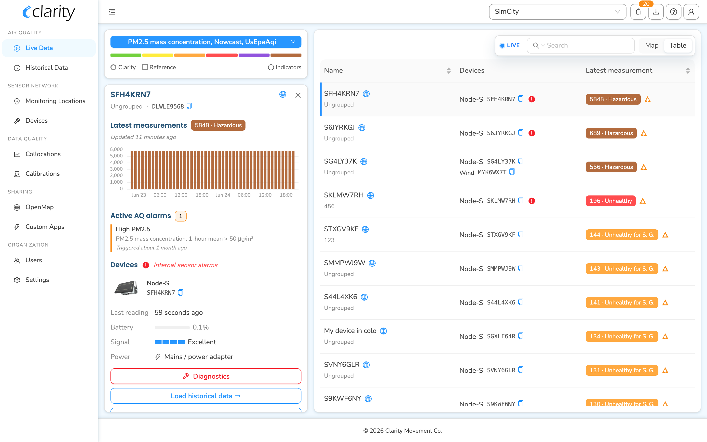
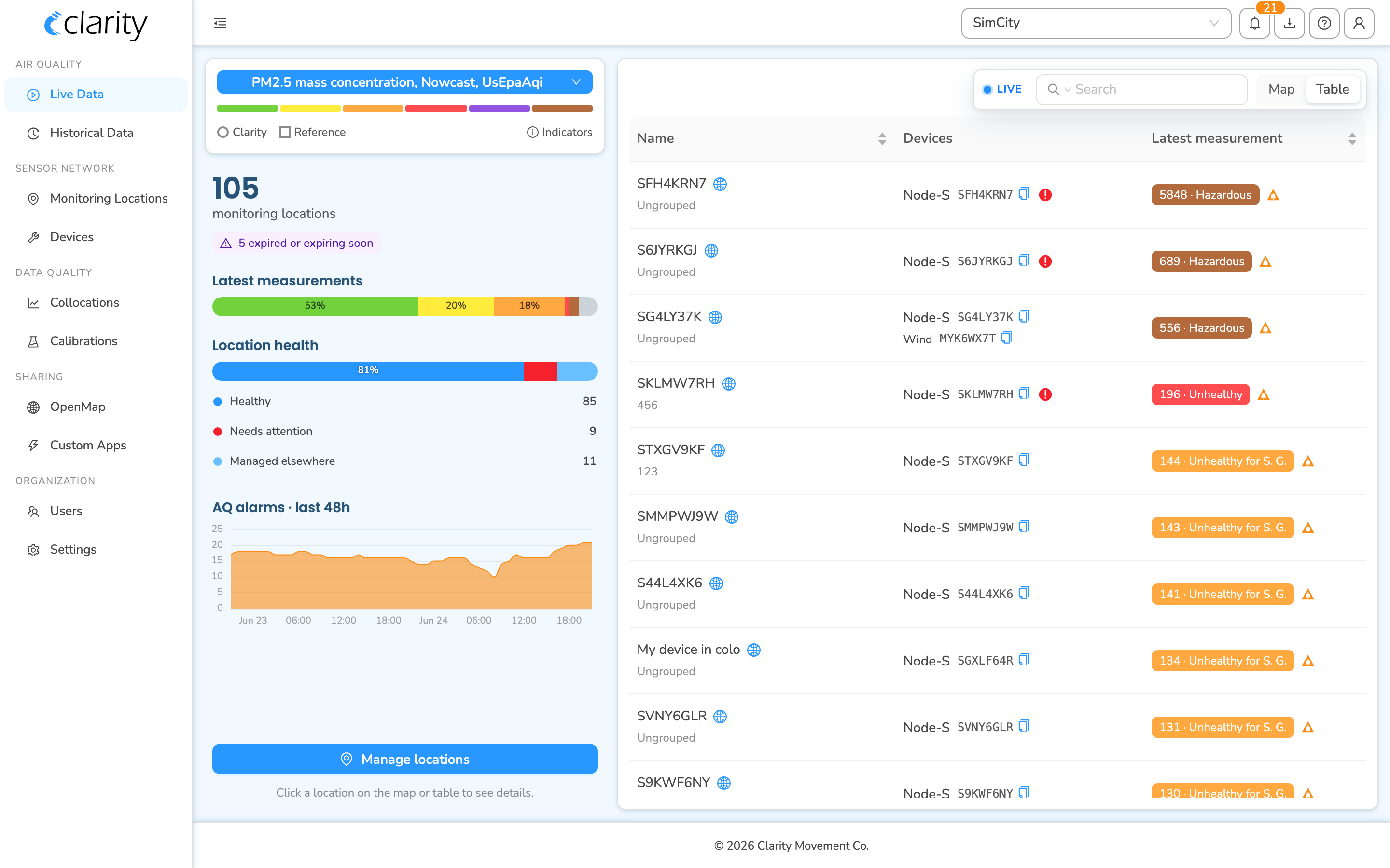
Jumping between views from a selected location
When you select a location in Live Data, the detail panel's device block offers quick actions and cross-page links:
- Diagnostics: opens a drawer with the node's connectivity, power, and sensor health.
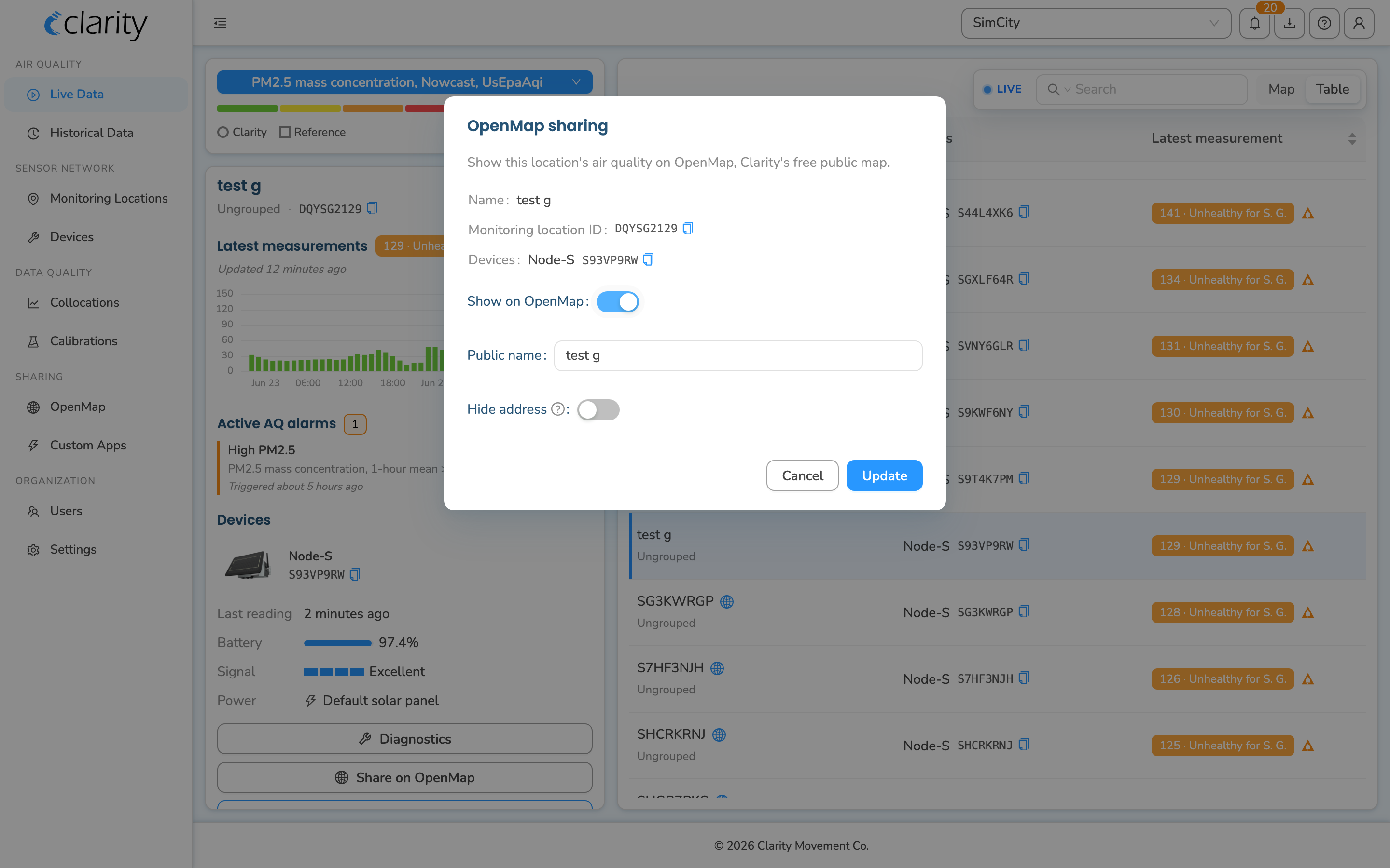
- Share on OpenMap: appears for locations your organization manages that aren't yet public; opens the OpenMap sharing dialog, covered in Clarity OpenMap below.
- Load historical data →: opens a small dialog to pick a time range and frequency, then takes you to Historical Data for that location.
- Manage monitoring location →: jumps to that location in Monitoring Locations.
Historical Data, Monitoring Locations, and Downloads
- Historical Data, in the Air quality section, is where you explore measurements over a chosen time range and frequency, compare locations, and dig into trends. You can reach it directly from the sidebar, or via Load historical data → from a selected location in Live Data.
- Monitoring Locations, in the Sensor network section, is the workspace for managing your locations, naming, grouping, sharing, and subscription status. This is also where you turn OpenMap sharing on or off.
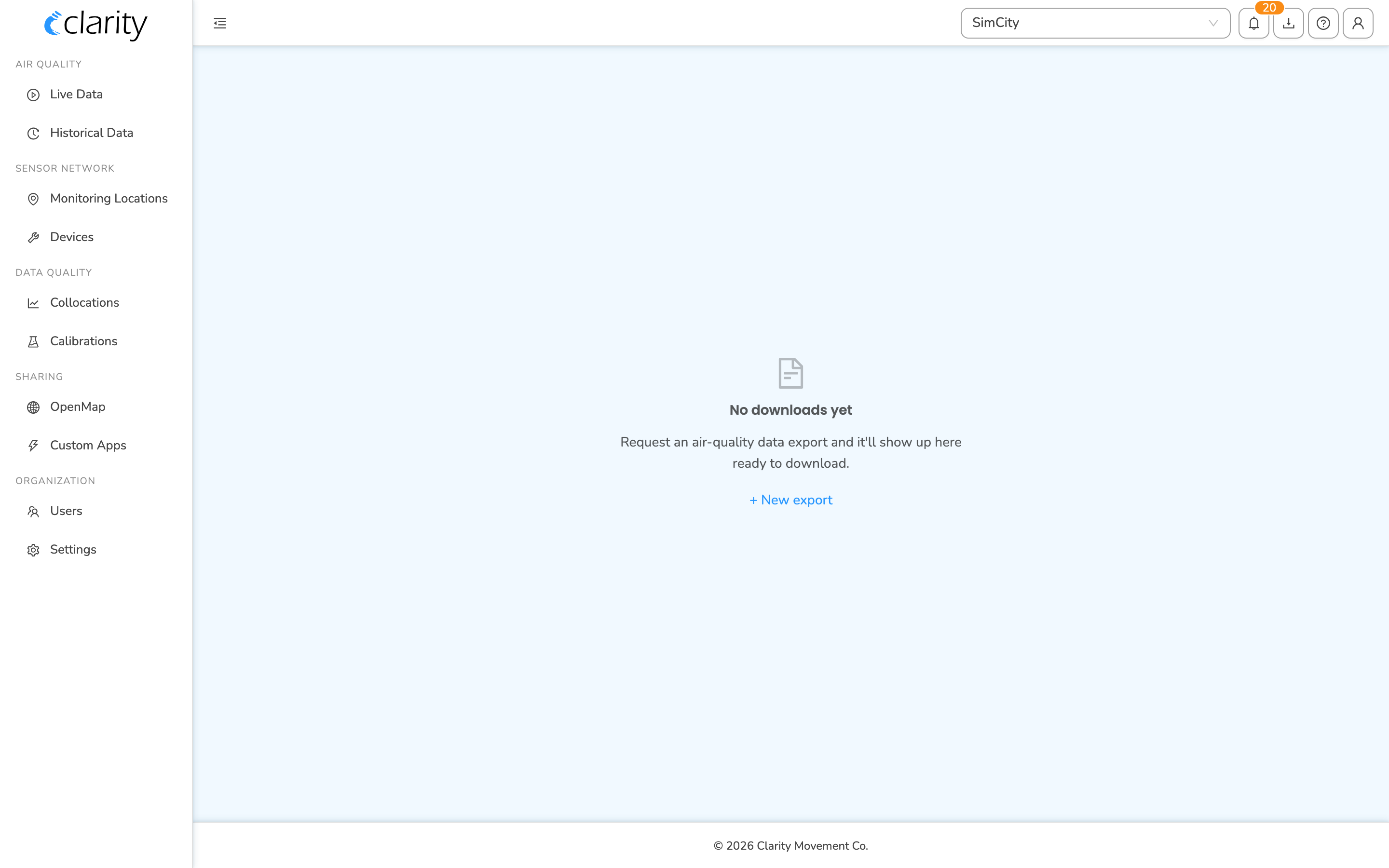
- Downloads, reached from the sidebar, is where you generate and retrieve
.csvexports of your data. See Download your air quality data for the full walkthrough.
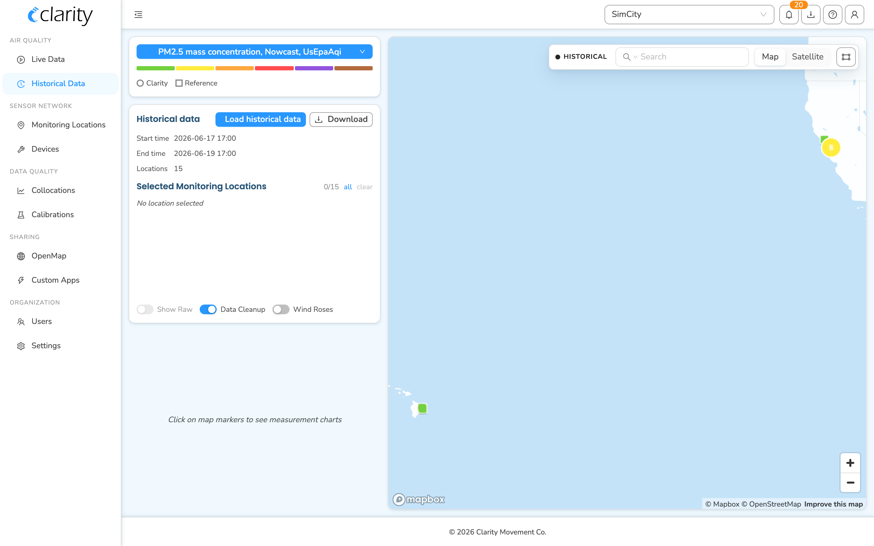
Add or remove reference monitor sites
Nearby public reference monitors appear on your Dashboard automatically, any with public data within 10 km of a deployed Node. You can also add or remove reference monitor sites yourself from the Monitoring Locations page, without contacting support.
You must be an org admin to add or remove reference sites.
- Open Monitoring Locations from the sidebar, under SENSOR NETWORK.
- Click + Add and select Add a reference site. A map populates with the available reference sites.
- Click a site on the map to subscribe to it, or click a site you're already subscribed to remove it.
- Click Save changes.
Reference sites you subscribe to then appear alongside your own locations, listed under the Managed elsewhere status since your organization reads their data but doesn't operate them.
2. Clarity API
You can also access your data programmatically via the Clarity API to integrate your Clarity data with existing or third-party platforms. An API key is required.
For endpoints, authentication, and examples, see the API Documentation Guide.
3. Clarity OpenMap
Clarity OpenMap is an easy way to publicly share your air quality data with a broader community, when you choose to. Your data is never shared without your permission.
Sharing a location on OpenMap
You can publish a location to OpenMap from inside the Dashboard:
- From Live Data, select a location and click Share on OpenMap in its detail panel, shown for locations your organization manages that aren't already public, or
- From Monitoring Locations, open a location and use its OpenMap sharing control.
Either path opens the OpenMap sharing dialog, where you set a public name, choose whether to hide the address/street view, and turn sharing on. To stop sharing a location later, use the OpenMap sharing control in Monitoring Locations. The Live Data button is a one-way "publish" shortcut.
For the full walkthrough, see How to make your air quality data public.
If you need assistance accessing your data, please contact us at support@clarity.io and we'd be happy to help.
What's next
Still need a hand? Email us at support@clarity.io or create a support ticket, and our team will get back to you.
Was this helpful?